Our Work
Dymaptic delivers measurable results for enterprise and government organizations. Explore our success stories to see how we solve real geospatial challenges with AI-first solutions.
Success Stories
 GIS Administration
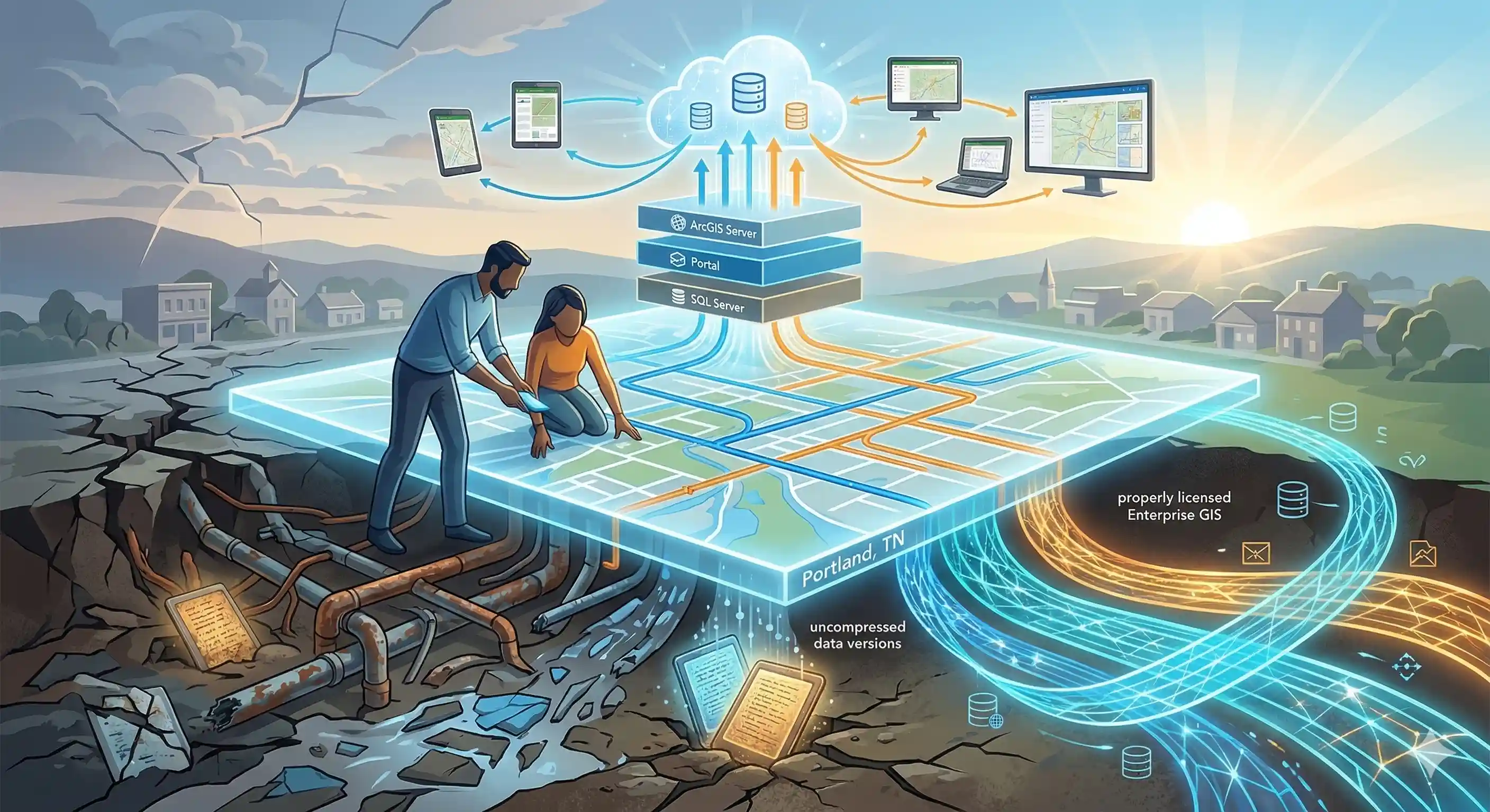
ArcGIS Enterprise Overhaul for Portland, Tennessee Utilities Department
City of Portland, Tennessee, Department of Utilities
dymaptic helped the City of Portland, Tennessee rebuild their utilities department's ArcGIS Enterprise environment from the ground up, resolving licensing issues, recovering buried data, and training the GIS administrator to manage the system independently.
Read case study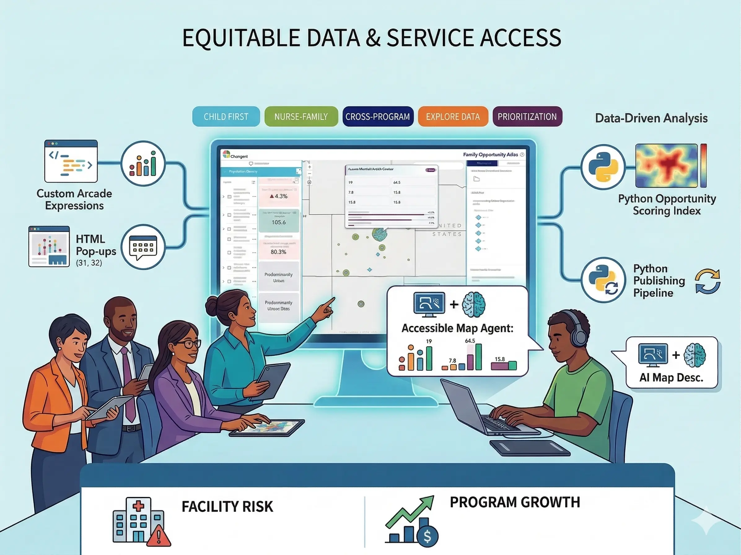 Geospatial AI Strategy
Accessible by Design: Building the Family Opportunity Atlas with Changent
Changent
dymaptic built the Family Opportunity Atlas, an accessible ArcGIS Online platform that unifies Changent's national health equity data and program service areas to drive informed decisions about community need and program reach.
Read case study GIS Administration
FEMA Floodplain GIS Data Download Automation
Local Government Entity
Manual floodplain data updates create unnecessary overhead for local government staff, so dymaptic built an automated Python solution that keeps the data current without any staff involvement.
Read case study Software Development
Technical Architects for Green Building Registry®
Earth Advantage
When the Green Building Registry® stalled on its path to launch, Earth Advantage brought in dymaptic to organize the roadmap and deliver the platform on time.
Read case study Software Development
Building Performance Database
Earth Advantage
Led the full rebuild of the U.S. Department of Energy's Building Performance Database from end-of-life Java Applets to a modern Angular, Python, and Google Charts stack, delivering a faster, accessible experience for public users.
Read case study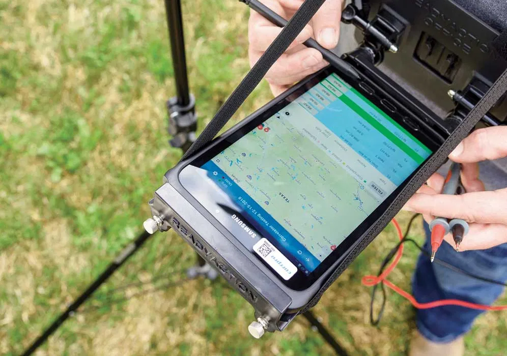 Software Development
Mobile Data Collection
Premier Provider of Pipeline Protection Solutions
Hundreds of field workers across the US and Canada now use a fully digital pipeline inspection system, built by the dymaptic team, to replace a process that once ran entirely on paper.
Read case studyReady to Be Our Next Success Story?
Contact dymaptic to discuss how we can deliver measurable results for your geospatial initiative.