The Challenge: A Spatial Operation Looking for a CRM
Blue Pine's operation is spatial from end to end. Every assessment, mitigation plan, and report is tied to a specific property. When they first engaged with dymaptic, they were looking to develop a GIS platform that would integrate with a CRM.
Our Approach: Run the Whole Operation Inside ArcGIS
In a two-day workshop, dymaptic proposed running the whole operation inside ArcGIS instead, with location and address as the primary entity. The architecture was designed so Blue Pine could have the option to add an enterprise CRM later without starting over.
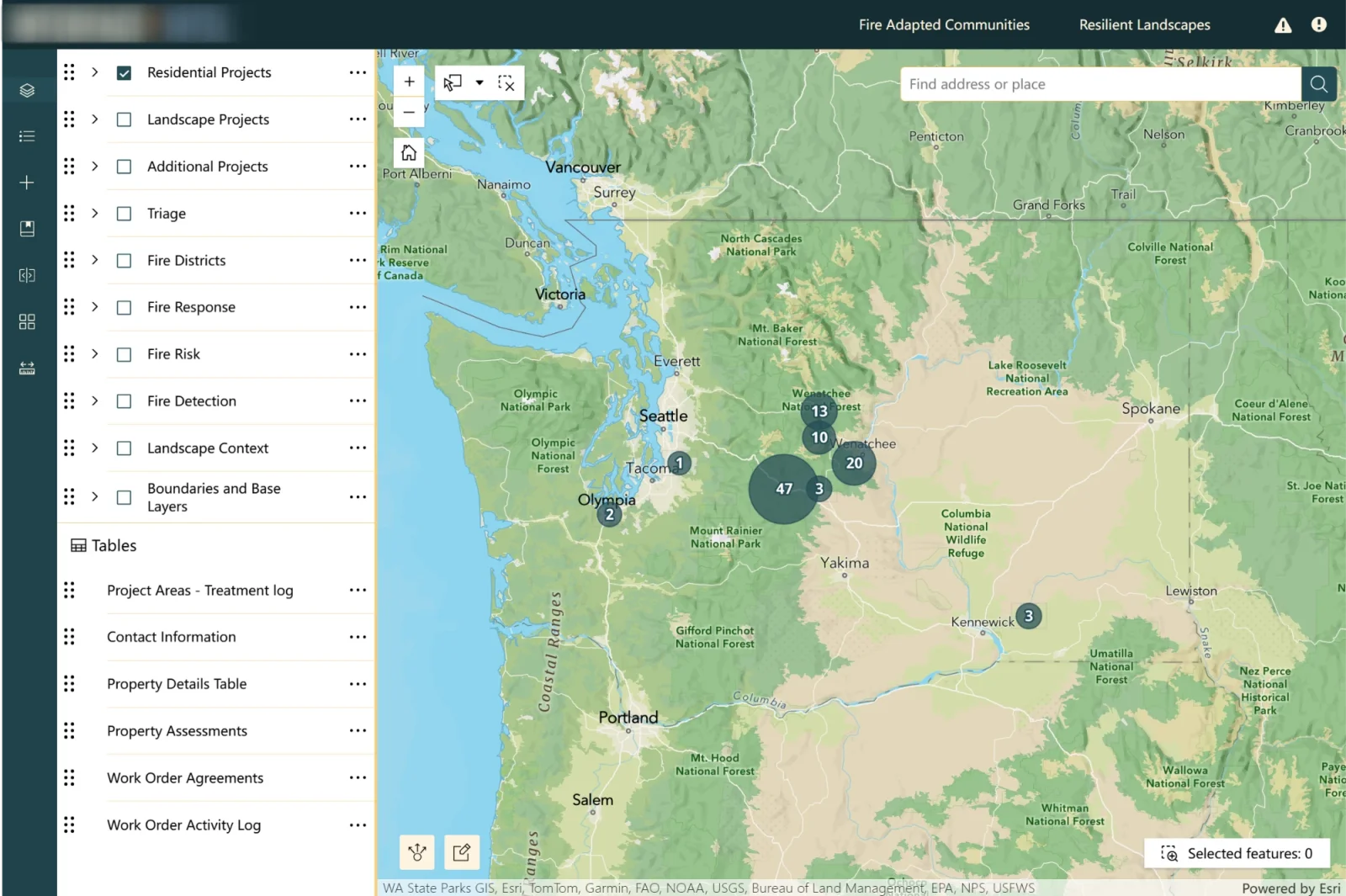
InterfaceIntel Map Explorer
Our Solution: One ArcGIS System from Intake to Report
Dymaptic delivered an ArcGIS-based system covering the full range of the company's mitigation operations. The platform includes:
- A single ArcGIS Experience Builder application centralizing property assessments, triage surveys and work orders, with parcel- and community-level views, status symbology and crew assignment.
- Three Survey123 forms: a public intake form embedded on the website for new submissions, a detailed property assessment capturing structure and site conditions plus mitigation estimates, aligned to Insurance Institute for Business & Home Safety (IBHS) Wildfire Prepared Home standards, and an on-site scope-of-work form for customer approval and a same-visit discounted-work option.
- An offline-capable ArcGIS Field Maps map where field crews complete assessments and work orders on site, with no connection required. Completed work updates the assessment record and syncs to a real-time operating view.
- An ArcGIS QuickCapture app for rapid structural triage, with triage points tied to parcel data, for community-scale work where a full assessment isn't the goal.
- Automated PDF assessment and work-order reports built with ArcGIS Notebooks (Python) and Zapier, including field photos, delivered to homeowners and assessors by email.
- An event-driven Zapier automation layer using secure webhooks to trigger customer communications and internal workflows.
- County parcel data hosted and joined into the system, driving assessment calculations and property records, alongside fire-risk, fire-district and landscape-context layers.
- Evacuation zone analysis that intersects current parcels to count structures and sum building values within a zone, extending the platform from pre-fire mitigation toward response planning.
- Ongoing support and enhancement, including expanded offline field capability, point/line/polygon work-order geometry, and automated backups.
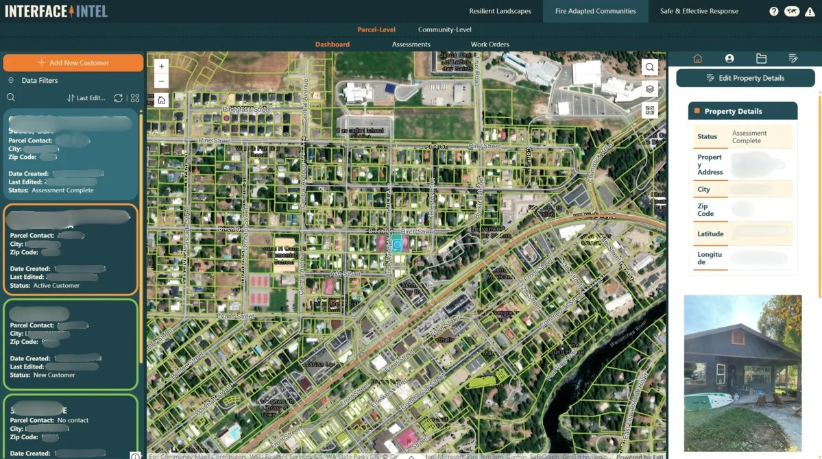
Parcel-level assessment dashboard
The Impact: ArcGIS Running Operational Work
Blue Pine runs its mitigation operations on one system, InterfaceIntel. Assessments are captured against a recognized industry standard, so what a homeowner is told is consistent from assessor to assessor. Crews collect offline in the field and the work appears in a map-based operating view the office can see. Estimates are presented and approved on site, which means work can close during the assessment visit. Reporting and customer communication that were manual are now automated. The result is ArcGIS running operational work, not just mapping it.
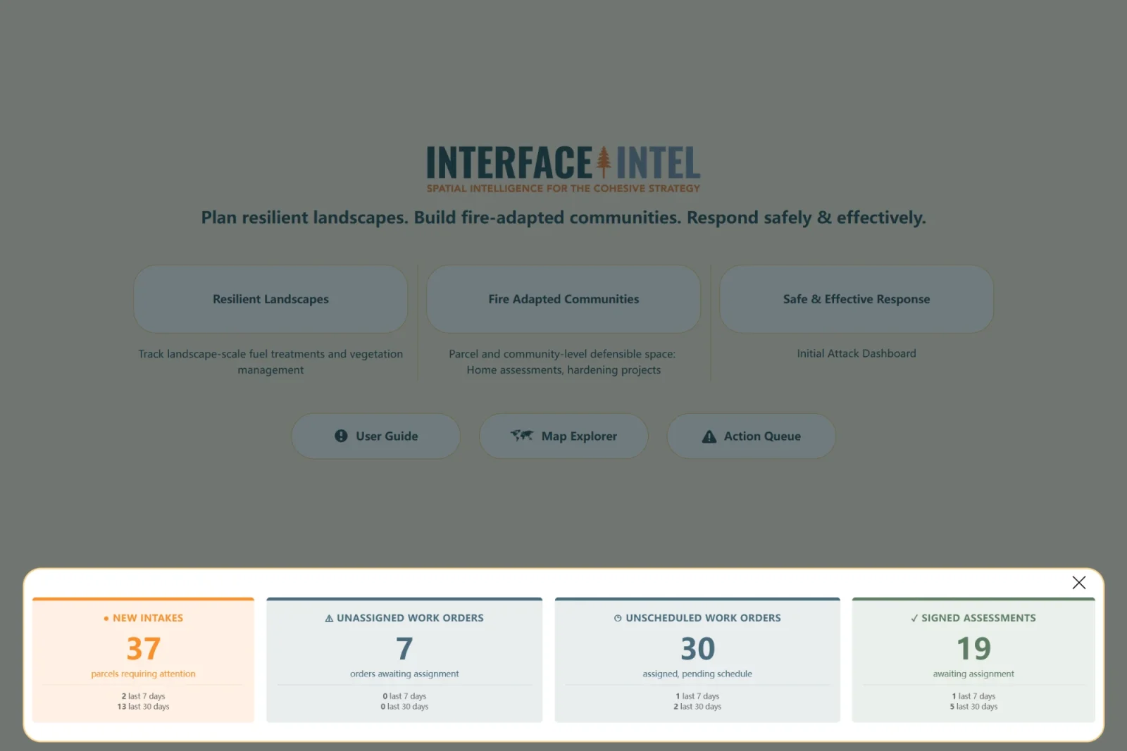
InterfaceIntel operations dashboard