Our Services
Every engagement starts with a conversation. We take the time to understand your organization, your challenges, and your goals before recommending any approach. If you don't know exactly what you need yet, that's okay!
From there, we bring the right mix of geospatial knowledge and AI capability to every project, delivering custom solutions across strategy, software development, and system administration. As an Esri Gold Partner and woman-owned small business, dymaptic has earned the trust of Fortune 500 companies, government agencies, and nonprofits alike.
Geospatial AI Strategy & Implementation
The right geospatial AI strategy depends on where you are and where you want to go. We help organizations identify where location data and AI can create the most value, then build a roadmap to get there. Every strategy is built around your goals, your infrastructure, and your team's capabilities.
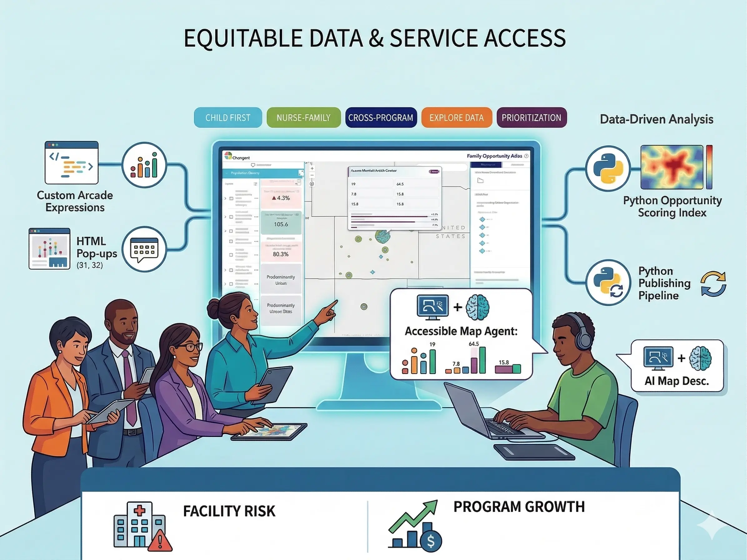
Our geospatial AI work spans spatial machine learning models, automated feature extraction from imagery, predictive analytics for location-based decisions, and natural language interfaces for GIS queries. Every dymaptic solution is designed to integrate with your existing ArcGIS or open-source GIS environment.
Key Capabilities
- AI readiness assessments for geospatial organizations
- Spatial machine learning model development and deployment
- Automated feature extraction from satellite and aerial imagery
- Natural language and conversational interfaces for GIS
Free AI Discovery Session
Not sure where AI fits into your geospatial work? Meet with our geospatial AI experts for a focused conversation about your data, tools, and goals, and walk away with an honest read on where AI could make a real difference for your organization.
Geospatial Software Development
We design and build custom geospatial applications that fit your workflows, not the other way around. Whether it's an interactive web map, a dashboard that turns location data into decisions, a mobile tool for field staff, or a custom ArcGIS integration, we deliver software built around your specific challenges.
The dymaptic team works with modern frameworks including ArcGIS, .NET, Blazor, and open-source geospatial tools. We are also the creators of GeoBlazor, an open-source library that enables .NET developers to build interactive mapping applications. Every project follows rigorous quality standards with automated testing, CI/CD, and ongoing support.
Key Capabilities
- Custom web mapping and GIS application development
- Mobile and desktop tools for field staff and analysts
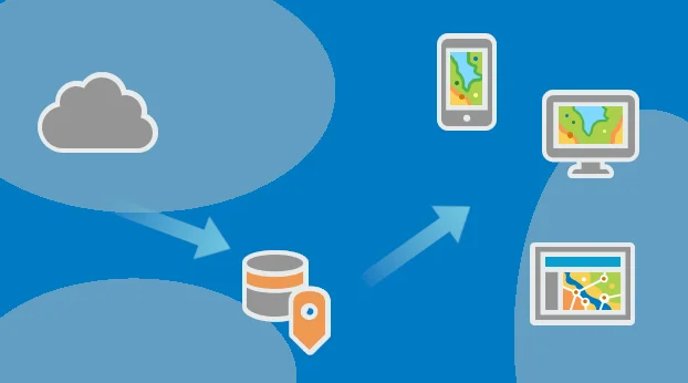
- Spatial data pipelines and ETL workflows
- API development and geospatial system integration
- Open-source GIS tooling and GeoBlazor development
Success Stories

Earth Advantage — Building Performance Database
Led the full rebuild of the U.S. Department of Energy's Building Performance Database from end-of-life Java Applets to a modern Angular, Python, and Google Charts stack, delivering a faster, accessible experience for public users.
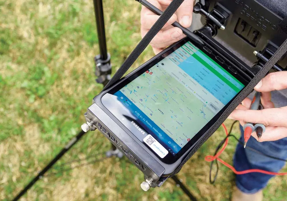
Pipeline Protection Solutions — Mobile Data Collection
Hundreds of field workers across the US and Canada now use a fully digital pipeline inspection system, built by the dymaptic team, to replace a process that once ran entirely on paper.
Free GIS Discovery Session
Have a geospatial application idea you want to explore or a stubborn problem you haven't been able to solve? Meet with our development team to talk through what you're working on and gain a clearer picture of what's possible.
GIS System Administration
Your GIS infrastructure should support your team, not slow it down. Dymaptic provides expert administration of enterprise geospatial systems, with a focus on solutions you can rely on long-term. Our goal is always to set you up for sustainable success, not create ongoing dependency.
Our administrators handle everything from initial setup and migration planning to ongoing monitoring, patching, and user management, across ArcGIS Enterprise, ArcGIS Online, PostgreSQL/PostGIS, and SQL Server spatial databases.
Key Capabilities
- ArcGIS Enterprise deployment, configuration, and upgrades
- Spatial database administration and performance tuning
- Cloud and hybrid GIS infrastructure management
- Monitoring, security patching, and disaster recovery planning
Free GIS System Check
Not sure if your GIS infrastructure is set up for long-term success? Meet with our team for a focused conversation about your current environment, and walk away with an honest picture of where you stand.
Frequently Asked Questions
What does a geospatial AI engagement look like?
How do you build custom geospatial applications?
Do you work with ArcGIS Enterprise and ArcGIS Online?
How long does a typical project take?
Can you work with our existing GIS infrastructure?
What industries do you serve?
Let's Build Something Together
Contact dymaptic to discuss how our geospatial services can support your organization's goals.